Sungai Tekala Malaysia Waterfalls
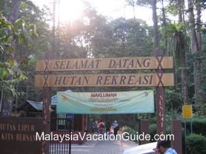 |
| The entrance to Sungai Tekala Recreational Forest |
Sungai Tekala Recreational Forest which is located about 14km away from the town of Semenyih in the district of Hulu Langat, Selangor. The distance from Kuala Lumpur is approximately 50km. This recreation park was established in 1982 for the public to enjoy the beauty of the tropical rainforest in Selangor.
The waterfalls here are easily accessible with plenty of parking bays. Concrete steps have been built to enable you to climb up to the cascading waterfalls which is usually crowded especially during the weekends. This place is an ideal get-away for the entire family as you will be able to reach the waterfalls within 10 minutes of walking from the entrance.
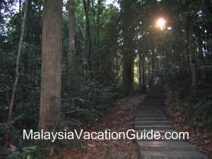 |
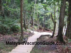
| The concrete steps that leads you to the many cascaded waterfalls. |
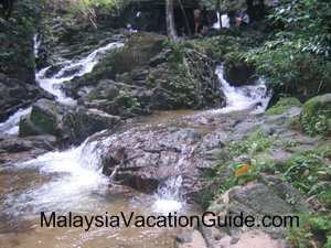 |
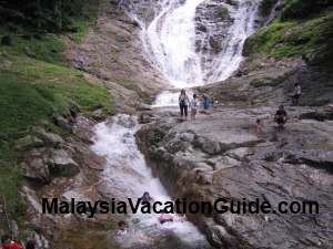
| One of the many waterfalls that you will encounter as you go up the forest. |
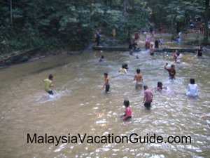 |
| Children enjoying themselves at the down-stream of the waterfalls |
Templer Park
Templer Park is located just after Kanching Recreational Forest if you are travelling from Rawang towards Kuala Lumpur trunk road. This park is another alternative for a time of recreation for the locals especially during the weekends.
It has an area of about 1200 hectares and is about 7km away from the town of Rawang. This park was named after Sir Gerald Templer who was the British High Commissioner to Malaya in the 1950s.
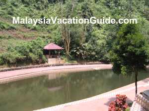 |
| The pool which you will encounter after a hike of 15 minutes from the base of the park. |
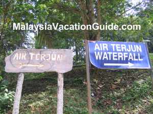 |
| If you want to hike to the waterfall which is a further 40 minutes away, follow the signage. |
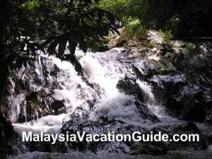 |
| The waterfalls about 50 minutes away from the base of the park. |
This forest is located between Rawang and Selayang. If you are coming from 1 Utama Shopping Centre, use the LDP and head towards Selayang and after that Rawang. Look out for the U-turn signage to Taman Rimba Templer before you reach Rawang.
Once you have U turned, drive slowly and look out for the entrance to the park on the left hand side of the road.
Those who have GPS can key in the following coordinates:
N 03° 17.151'
E 101° 38.649'
E 101° 38.649'
Lata Iskandar
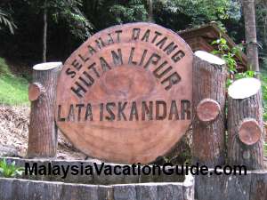 |
| Signage welcoming you to the falls. |
You will not miss it as there are many stalls set-up by the road side that sell handicrafts work, drinks, snacks and other produce from this area.
 |
| The waterfalls taken from the base. |
 |
| The concrete steps to help you go up Lata Iskandar falls. Take note of the trees and other plants here. |
Head for the North-South Expressway and travel towards Tapah. Exit at Tapah toll and turn left at the first traffic light after paying your toll. If you would like to take your meal or purchase some snacks, you need to turn right towards Tapah town.
Travel along the road that goes to Cameron Highlands and you will not miss this place.
If you have GPS, key in the following coordinates:
N 04° 19.441'
E 101° 19.521'
E 101° 19.521'
No comments:
Post a Comment